Challenge
Floods in urban areas highlight the vulnerability of cities and the complex challenges they face in managing growth and development. As urbanization accelerates, the impact of floods on densely populated areas becomes more pronounced, with development often pushing into low-lying, flood-prone areas. Climate change exacerbates these issues through increased precipitation and sea level rise, leading to more severe and frequent flooding.
The Acari River basin in Rio de Janeiro (Figure 1) is a highly populated and flood-prone region, and heavy floods have impacted it in the past. It is characterized by medium and low-income occupations and several non-planned urban developments. The area is particularly vulnerable to flooding due to its low-lying position, rapid urbanization, and inadequate drainage systems. In past floods, such as the significant event in 2010, tens of thousands of people were affected. During the most recent flood in January 2024, 78000 people were affected. These floods cause widespread damage to homes, infrastructure, and public services, with several neighborhoods in the Acari River basin being submerged (see the series of pictures below). Damage estimates may range into the hundreds of millions of reais, though exact figures are unknown. The frequency of such floods has led to ongoing efforts by the city of Rio de Janeiro to improve drainage, build protective infrastructure, and reduce the impact on communities living near the river. However, challenges such as rapid urbanization and climate-related heavy rains continue to make the region vulnerable.
[*] Deltares (https://www.deltares.nl/en)
[**] Fundação Rio-Águas (https://fundacaorioaguas.prefeitura.rio/)

Figure 1: Location map of Rio de Janeiro and the Acari River Basin.
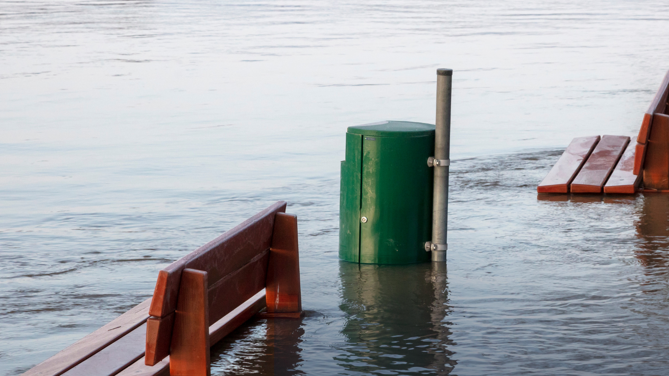
Pictures illustrating the impact of flooding in the Acari River Basin.


Approach to Flood Risk Assessment
City planning must become risk-informed to protect citizens, homes, and infrastructure from climate risks such as flooding. Conducting thorough flood risk assessments, and keeping these up to date as the city changes, is crucial for developing effective flood protection strategies and ensuring a sustainable urban future. To this end Deltares has developed two tools, HydroFlows, to make rapid and continuous flood risk assessments, and FloodAdapt, a decision-support tool to advance flood adaptation planning.
HydroFlows is a library of modular workflows for conducting flood risk assessments in a standardized and reproducible manner (Figure 2). The workflows include automated setup of physics-based models, statistical analysis, and impact assessments. The tool is backed up by a large stack of state-of-the-art global datasets to enable rapid assessments anywhere globally. As the workflows are fully automated these can easily be replaced by local data of better quality or updated data in a rapidly changing urban environment. The outcome of HydroFlows is not only the flood risk assessment results (flood maps and expected impacts for different climate and urbanisation scenarios) but also the automated workflow itself which can be handed over to city professionals for use in future studies to update the assessment as the city evolves and/or the climate projections change.

Figure 2: HydroFlows is a library of automated modular workflows for conducting flood risk assessments in a standardized and reproducible manner.
The flood risk assessment and underlying models as produced by HydroFlows can be seamlessly combined with FloodAdapt. FloodAdapt (Figure 3) is a tool to interactively explore different adaptation strategies to mitigate flood risk with an easy-to-use graphical interface that allows non-expert end users to evaluate adaptation strategies under a wide range of flood events. With this tool adaptation measures such as urban greening, water storage, but also elevating homes, buyouts and floodproofing can be investigated.

Figure 3: FloodAdapt is a decision-support tool to advance flood adaptation planning
Application in Rio de Janeiro
Within UP2030, Deltares works together with Rio-Águas, the municipal office for urban drainage, to combat these challenges. Rio-Águas is responsible for planning, implementing, and maintaining effective drainage systems. While the city possesses high-quality data, there is currently a lack of flood models to assess and predict flood risks in specific areas.
The area of interest is the Acari River Basin (Figure 1), for which Rio-Águas is in the process of developing a Drainage Masterplan that can guide future drainage interventions, optimize resources, and ensure the city’s resilience to flood risks. The main practical aim of this study was therefore to assist Rio-Águas in developing the Drainage Masterplan. From the perspective of UP2030, the scientific aim is to investigate the usefulness of global data sets in enhancing local flood risk assessments, considering their advantages and limitations. This will provide insights into how such data can complement local knowledge and decision-making in flood management. Figure 3 summarizes the flood risk assessment results for the Acari River Basin.

Figure 3: Results of the flood risk assessment for the Acari River Basin in Rio de Janeiro. (a). digital elevation model; (b). time series of local rainfall; (c). rainfall statistics (hyetographs) turned into event sets for specific return periods (RPs); (d). hazard map of Acari River Basin (RP= …); (e). flood risk expressed in terms of expected annual damage (EAD in $).
The Acari River Basin study proofed to be very valuable, as Rio de Janeiro has a wealth of high-quality local datasets. This enables us to compare results based on global data and results based on partly global and local data (Figure 4). By combining these local datasets with public global data, we were able to analyse how the HydroFlows approach can support urban drainage strategies and contribute to more informed, effective flood risk management.

Figure 4: comparison between flood map (return period = 100 years) derived with global (left) and local rainfall data (right).
Further collaboration and workshop
We are currently in the process of discussing with Rio-Águas possible solutions and adaptive pathways to mitigate the risks of flooding using FloodAdapt. We have planned a workshop and training week in April 2025 with field excursions, discussions on green infrastructure, training in the use of the tools, and in which the tools will be transferred to Rio-Águas to ensure these can continue to support the city beyond the scope of the project.
Authors: Dirk Eilander, Athanasios Tsiokanos, Hans Gehrels, João Paulo Fraga, Patrícia Ney de Montezuma
References and links:
FloodAdapt (flood adaptation support tool): product page
HydroFlows (rapid flood risk assessment tool): first release early 2025
SFINCS (flood model): product-page
Delft-FIAT (impact model): product-page

Funded by the European Union. Views and opinions expressed are however those of the author(s) only and do not necessarily reflect those of the European Union or the European Climate, Infrastructure and Environment Executive Agency (CINEA). Neither the European Union nor the granting authority can be held responsible for them. This project has received funding from the Horizon Innovation Actions under the grant agreement n° 101096405.