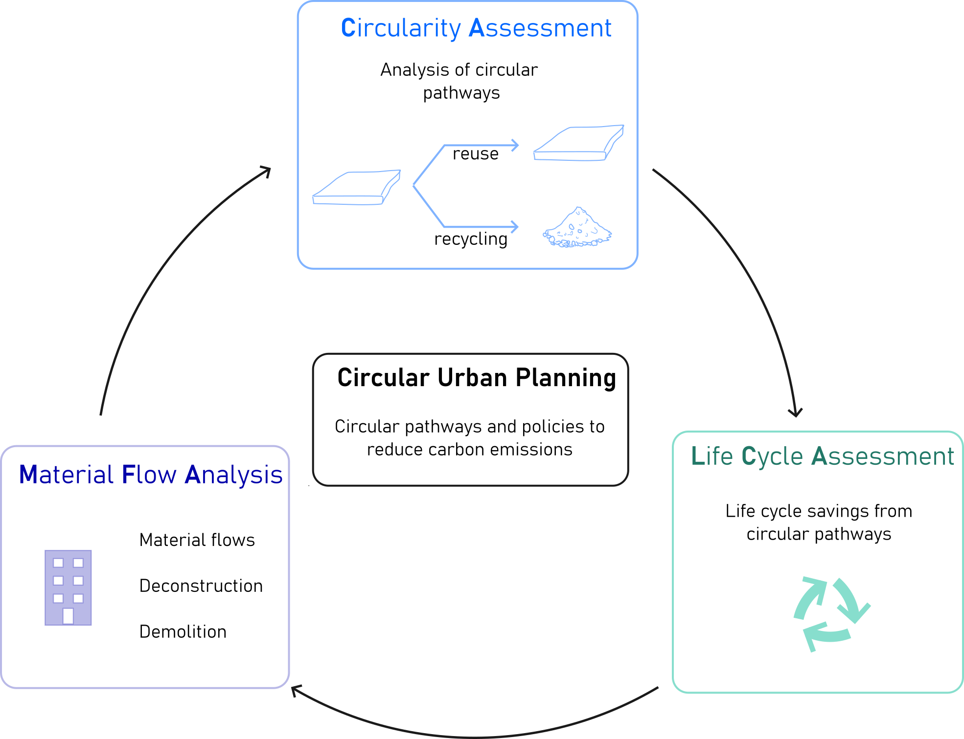
Circular Urban Planning is a modeling framework designed to support decision-making around urban-scale material reuse and circularity in the built environment. The tool assesses when and where reusable construction elements may become available from buildings reaching end-of-life, helping cities map out material flows, track circularity metrics, and evaluate life cycle environmental impacts. At its core, the tool combines Material Flow Analysis (MFA), Dynamic Life Cycle Assessment (DLCA), Circularity Assessment (CA), and Geographic Information Systems (GIS). This bottom-up approach enables the spatial and temporal prediction of reclaimable elements during demolition or disassembly. Reusable components are catalogued in a database with associated metrics to guide reuse strategies and reduce the demand for new raw materials.
Originally developed and tested in Switzerland, the tool is now being adapted for use in UP2030 pilot cities, such as Thessaloniki and Istanbul, by integrating local cadastral, GIS, and construction data. A user input layer also allows for refinement based on technical feasibility, real building characteristics, and dynamic energy assumptions (e.g., evolving electricity grid emissions). Key functionalities include identifying and mapping potentially reusable building components, estimating embodied environmental flows using regional or open-source databases, answering scenario-based questions such as “What is the life cycle impact of replacing all single-glazed windows with reused double-glazed ones?”; and exporting results in Excel format for integration with other digital tools.
Though initially developed using Swiss datasets, the Circular Urban Planning tool is being adapted for use in UP2030 cities by assessing data availability and readiness in locations such as Thessaloniki, Istanbul, Lisbon, and Budapest. A key step in this adaptation process has involved surveying municipalities on the availability of GIS, cadastral data, and material stock records; identifying open-source environmental databases such as ICE (UK), KBOB (Switzerland), EPiC (Australia), and Ecoinvent for use as inputs in LCAs; and collaborating with cities like Thessaloniki, specifically the Kalamaria municipality, which have already mapped essential building characteristics including types, heights, areas, and construction periods.

Catherine De Wolf
dewolf@ibi.baug.ethz.ch

Dr. Pierre Navaro Auburtin
navaro-auburtin@ibi.baug.ethz.ch