City Scan is a parametric urban design and analysis workflow developed by TSPA to support real-time, data-driven, and participatory planning. By combining spatial analysis, data science, and urban design principles, the tool helps cities simulate and evaluate multiple urban scenarios based on interconnected parameters, such as building typology, green infrastructure, street layout, and mobility systems.
Unlike conventional static planning approaches, City Scan supports iterative testing and immediate feedback, helping users understand the spatial, social, and environmental trade-offs of planning decisions.
Its customizable and iterative nature makes it especially useful for co-design sessions and stakeholder meetings, to visualize complex ideas and reveal trade-offs such as density and green space and many more. In UP2030, it has been applied in Granollers to guide the transformation of La Bòbila into a climate-resilient, inclusive, and net-zero neighborhood.
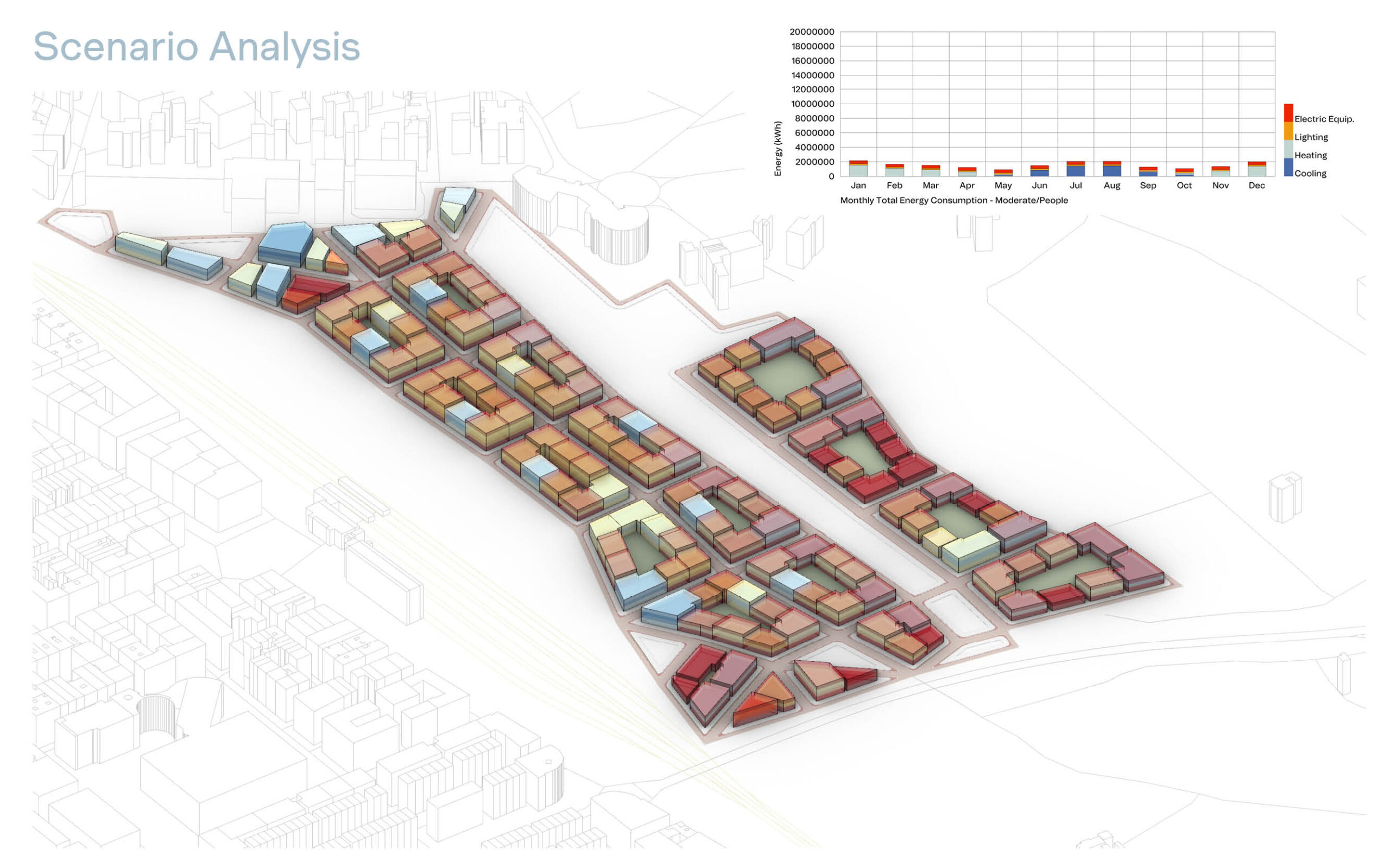
In Granollers, City Scan was applied to develop and compare four urban design scenarios for La Bòbila neighborhood, each testing different balances between socio-economic (people centered) and nature-centric strategies. It enabled the city to optimize walkability and service access; strategically integrate green infrastructure such as bioswales and green roofs; assess building orientation and typology for solar energy performance; identify risk-prone areas and design for flood and heat resilience; and tailor urban planning parameters to the neighborhood’s specific challenges and opportunities. The results are used to directly inform urban development guidelines for climate-resilient design, tendering processes for future neighborhood plans, and the creation of a shared visual language for stakeholder engagement and communication.
Aurelija Matulevičiūtė-Goldschmidt
am@tspa.eu