Urban Carbon Emission Data Mapping is a methodology developed by the University of Cambridge (UCAM) under UP2030 to assess how well cities collect, share, and use carbon emission data in their decision-making processes. Still in early development (TRL 2), this tool does not yet exist as a digital product but functions as a research-based framework for understanding the flow of carbon data across departments and decision-makers. The goal is to map the entire ecosystem of carbon data governance within a city, identifying bottlenecks, gaps, silos, and opportunities for improved information flow. This helps guide local governments to better manage carbon emissions data and align it with broader net-zero and climate neutrality goals. The mapping process is informed through interviews with municipal stakeholders, assessing how decisions related to emissions are made, where carbon data exists and how accessible or trusted it is, how departments communicate and share emissions information, and how well data flows support cross-sectoral climate actions.
In Muenster, the Urban Carbon Emission Data Flow Mapping supports the enhancement of data governance policies for climate action. It helps identify which departments have access to carbon data and where critical gaps exist, informing the development of more integrated emissions management strategies across neighborhoods. Additionally, it complements the BuroHappold climate proofing methodology by aligning emissions data with strategic planning efforts.
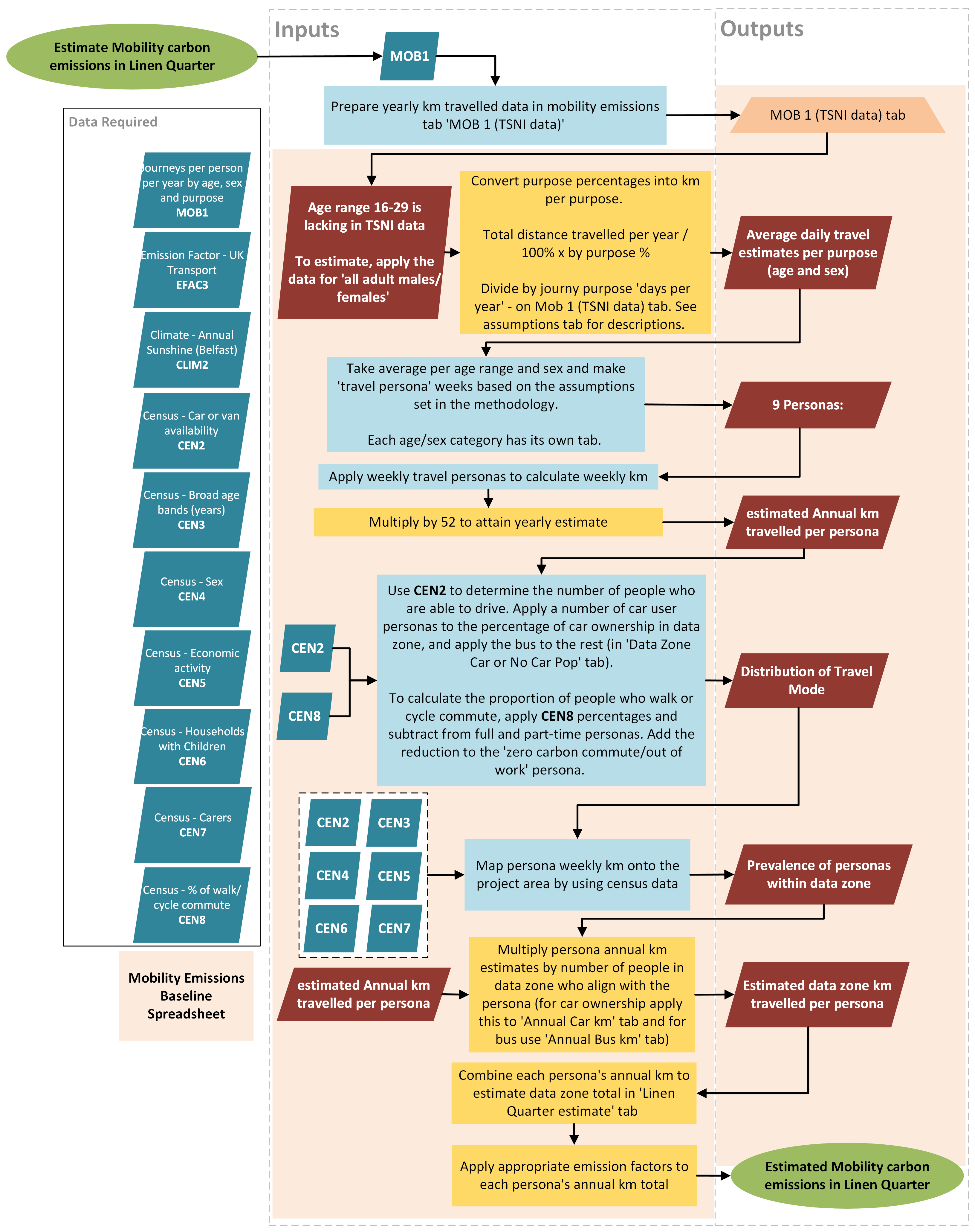
In Belfast, the methodology supports Scope 4 accounting for active travel interventions in the Linen Quarter. It maps how emissions data - from Belfast City Council (BCC) and external inventories - informs decision-making, helping to integrate transport emissions modeling tools into urban planning. The pilot also assesses overall data readiness and guides future strategies to improve the quality and accessibility of emissions-related data.

Dr Kristen MacAskill
kam71@cam.ac.uk