
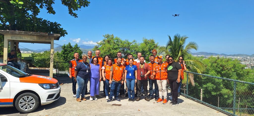
Two weeks ago, as part of UP2030, Rio-Águas and Deltares jointly hosted an intensive training workshop for technical staff from the Rio City Hall, titled “Advancing Flood Resilience in Rio de Janeiro.”
The hands-on training focused on hydraulic flood modeling and adaptive strategies for enhancing urban flood resilience. Participants were introduced to innovative tools developed within the UP2030 project—HydroFlows and FloodAdapt—which enable cities to assess flood risks and explore a range of green, blue, and grey adaptation measures. These tools will strengthen the capacity of Rio-Águas, the Operations Center (COR), and the wider City Hall to address flood risks more effectively.
As one of UP2030’s pilot cities, Rio de Janeiro plays a central role in integrating climate adaptation strategies into urban planning. The city’s current focus is on strengthening its flood resilience through better risk assessment and sustainable design interventions. Through the efforts of Rio-Águas and COR, Rio is identifying opportunities for improved drainage infrastructure—potentially supported by nature-based solutions—in line with the city’s vision for a climate-resilient future.
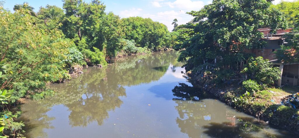
The training targeted the Acari River Basin, a densely populated and flood-prone area that experienced severe flooding in January 2024, impacting more than 78,000 residents. Using local datasets combined with global public data, participants applied the new tools to develop more informed and effective flood risk management strategies for the basin—ultimately contributing to climate-resilient development.
A Week of Intensive Training
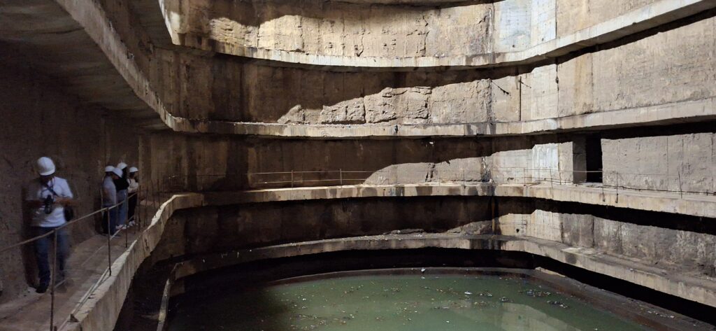
The week began on Monday morning with an introduction session, bringing together staff from the City Hall, Rio-Águas, COR, and the Deltares team. The purpose was to align everyone on the background and objectives of the workshop. In the afternoon, a field excursion took participants to the Niterói Reservoir near Bandeira Square, where discussions focused on interventions and reservoir operations.
On Tuesday morning, the group visited the Acari River Basin, guided by a representative from the Civil Defence department. This visit provided a direct understanding of the local challenges and allowed an exchange of ideas regarding Rio-Águas' ongoing efforts and future goals for improving flood resilience in the area.
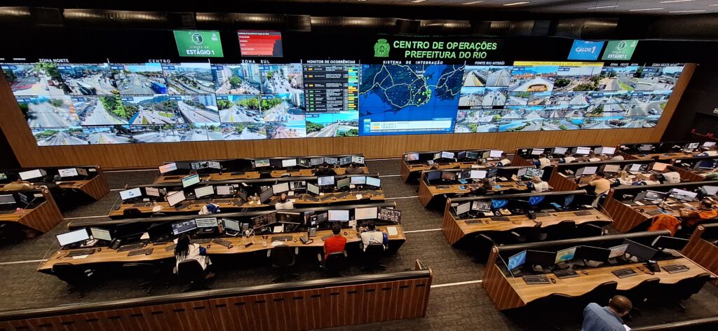
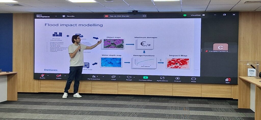
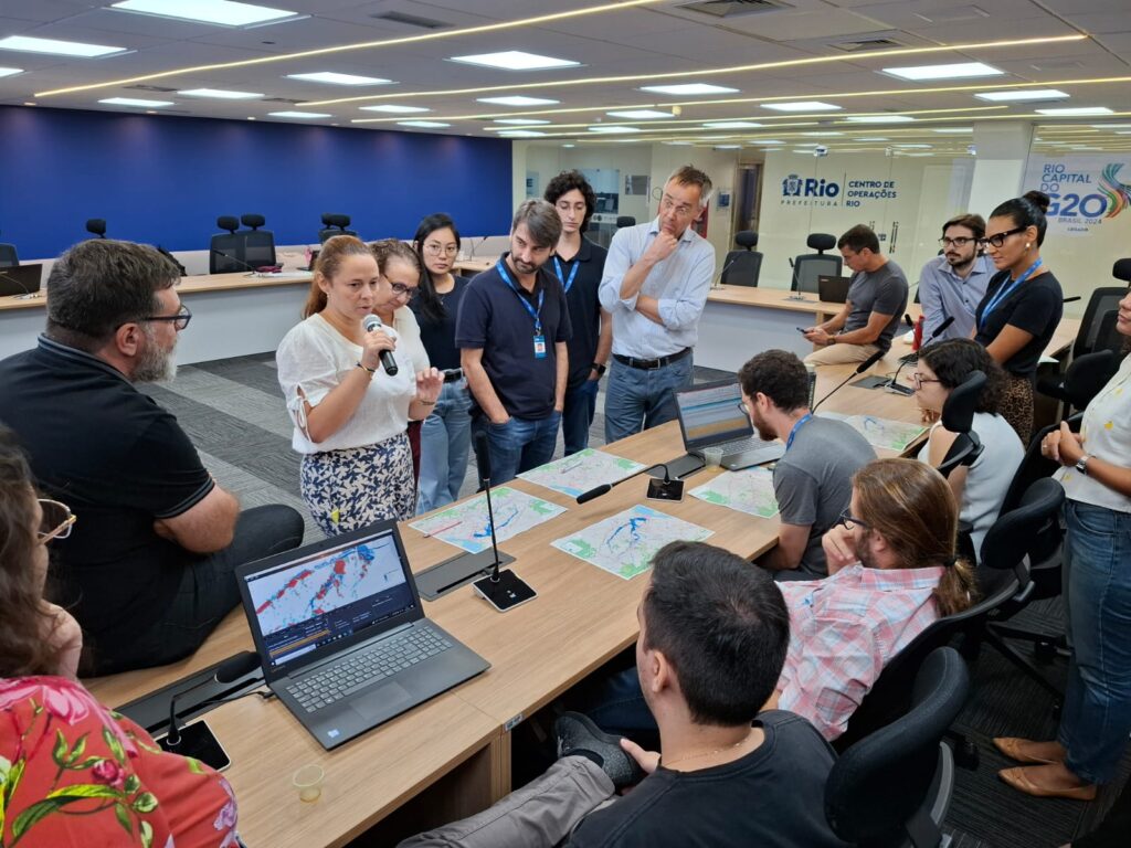
The afternoon was dedicated to a hands-on training with SFINCS (Super-Fast Inundation of CoastS), a new reduced-complexity flood modeling engine developed by Deltares. Participants learned about the physics of compound flooding, how to efficiently simulate flood scenarios, and how to interpret model inputs and outputs for research and decision-support. Wednesday morning featured a visit to the Operational Center’s Control Room, offering insights into how COR manages different types of hazards across the city.
In the afternoon, participants engaged in a practical session using FloodAdapt. This decision-support tool enables rapid modeling of flood impacts and adaptation options, making it accessible to non-expert users. Participants explored future flood scenarios involving climate change, population growth, and extreme weather, and learned how to test adaptation strategies such as levees, pumps, and building floodproofing.
Thursday’s program focused on solution strategies. In the morning, participants discussed the benefits and trade-offs of grey, green, blue, and hybrid infrastructure solutions. The set of NBS was based on recently published catalogues from the World Bank, GIZ and Urban GreenBlue Grids. Using Multicriteria Analysis (MCA), they evaluated intervention packages based on factors such as economic impact (including expected annual damage and effects on critical infrastructure), environmental outcomes (like water quality, drought resilience, and heat stress), social and health impacts (including the number of people affected by flooding and overall livability), as well as costs and implementation feasibility. The discussions highlighted the complexity of selecting the most effective combination of measures for the Acari Basin.
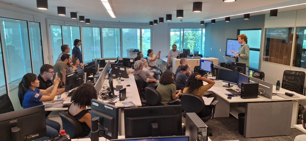
In the afternoon, the group shifted focus to HydroFlows, a modular library that enables standardized and reproducible flood risk assessments. Participants practiced setting up workflows, updating datasets, and running impact assessments, learning how HydroFlows can easily integrate new or local data to support rapid assessments in changing urban environments.
The workshop concluded on Friday with a plenary session to reflect on lessons learned and discuss next steps. Participants evaluated how to sustain the new modeling experience, how the selected solutions align with Rio’s PDS and drainage masterplan, and how to continue collaboration.
Key Takeaways and Insights
The workshop was seen as highly productive, with participants enthusiastic about the hands-on approach that allowed immediate application of new skills. The tools introduced were appreciated for their potential in preliminary flood risk analysis and early warning systems, and the concept of translating flooding into tangible impacts such as economic damage and affected populations was particularly well-received. This new ability to communicate risk in accessible terms could support Rio-Águas in working more effectively with other city departments and the public. In particular, FloodAdapt stood out as a valuable tool for visualizing and communicating risk information clearly and convincingly.
Several areas for improvement and future action were also identified. On a governance level, Rio-Águas recognized the need for stronger collaboration with other departments—such as urban planning—to address exposure and vulnerability factors like floodproof building design. Implementing the new modeling tools on a broader scale will also require investing in new ways of working and building technical capacity within the organization.
On a technical level, participants saw opportunities to refine the identification and prioritization of critical flood locations by developing severity levels and specific evaluation criteria. Improving the resolution and quality of local data will be crucial for conducting more detailed local-scale analyses, a topic that was not addressed in depth during the training but will be important for future work. Another avenue for development could be integrating existing modeling tools like HEC-RAS into the HydroFlows workflows.
As a next step, Rio-Águas will experiment with applying the new tools in another river basin, supported by regular four-weekly progress meetings to maintain momentum. The workshop has laid a strong foundation for further collaboration, capacity-building, and climate-resilient urban development in Rio de Janeiro.
By Hans Gehrels, Dirk Eilander, Athanasios Tsiokanos, Patrícia Ney de Montezuma, João Paulo Fraga

Funded by the European Union. Views and opinions expressed are however those of the author(s) only and do not necessarily reflect those of the European Union or the European Climate, Infrastructure and Environment Executive Agency (CINEA). Neither the European Union nor the granting authority can be held responsible for them. This project has received funding from the Horizon Innovation Actions under the grant agreement n° 101096405.